A tool-tip system allows the easy viewing of various details about each connected data stream and its base station.
Simply hover your mouse over the colored MountPt label for any stream and the tool-tip appears. More data is available when the stream is parsed. The reported location in the Caster Table will be used when the precise location is not available in the data stream, or has not yet been decoded. Generally speaking, the information found in this tool-tip is static and may require as long as 3 minutes to be acquired. When a stream is re-parsed the data displayed in minimal until the analysis process completes.
Typical Data
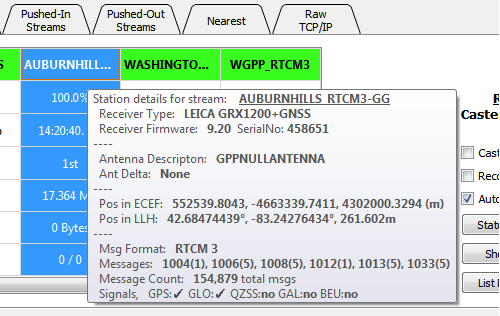
The data presented will vary depending on what information the data stream sends about itself, and what information SNIP can decode from the content of various messages. Here is a typical display.
When PFAT is in use
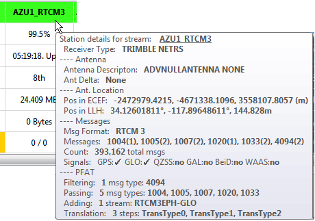
The data shown also reflects any PFAT settings which are then active. This allow an easy way to view any changes made to the original data steam. In the example below, a private message (4094) has been filtered (removed), and orbital data for GLONASS SVs has been added to the stream.
In the Case of RTCM2 Data
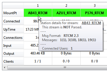
The amount and details of data provided by RTCM2 .x message is somewhat less than that of RTCM3.x but is also displayed:
In the Case of Ephemeris Data Sources
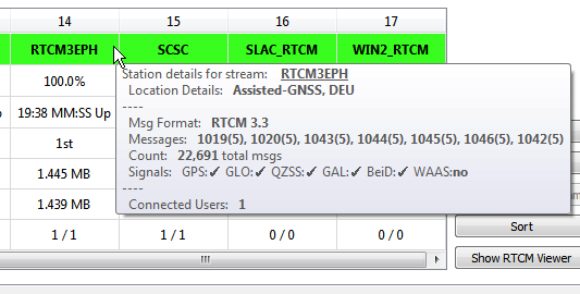
Streams such as “RTCM2EPH” often do not provide details such as a single location or a receiver type, as these streams are typically composite feeds generated by regional tracking centers. SNIP decodes the message content itself to determine additional information. This is also true for precise orbital offset data and clock data products.
In the case of NEARest Data Streams
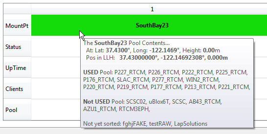
The SNIP data streams using the NEARest feature are composed of one or more individual data streams. Each of these streams can also be examined as per the above. The tool-tip provided for each NEARest stream provides a summary of the individual streams that make up the pool (and those excluded). Here is a typical tool-tip for some RTCM 2.3 data streams operating in the San Francisco Bay area.
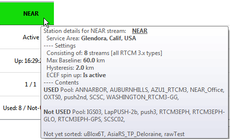
Here is a tool-tip which provides additional details (rev 2.x release) about the NEAR settings
Aside: For NEARest streams you can also use the menu item View Stream Users to get a quick summary of the connected users as well as which streams they are currently using.
The SouthBay23 mountPt has been active for 45:24 MM:SS and has 1 / 1 current users (current / total).
   This pool is made up of streams containing: RTCM 2.x types. Located near: SouthBayArea
   Using 13 Base Stations in the pool (6 rejected), Region is centered Lat: 37.4900, Long: -122.1400, Height: 0.00m, Width 50.0km, Max baseline of: 60.0km allowed.
         The Pool members are:   P227_RTCM,  P226_RTCM,  P222_RTCM,  P225_RTCM,  P176_RTCM,  SLAC_RTCM,  P277_RTCM,  WIN2_RTCM,  P220_RTCM,  P219_RTCM,  P177_RTCM,  P213_RTCM,  P221_RTCM,
   There are 1 connected clients at this time.
   Client: Laptop3 is 9.9397 km from P226_RTCM ; Now at: Lat: 37.4100°, Long: -121.9000°, Height: 65.39m, (507th NMEA input)
         Sent: 1.016 MB, Received: 42.18 KB (from:69.75.31.230:55092), Up: 42:17 MIN:SEC
Also: The revised right-click menu system also provides a means to easily display each station and its user community in its own map display.
The prior functions that displayed all base stations and all users are still present.
